Audubon Zoo Louisiana Swamp Exhibit
“The zoo covers 58 acres (23 ha) and is home to 2,000 animals. It is located in a section of Audubon Park in Uptown New Orleans, on the Mississippi River side of Magazine Street. The zoo and park are named in honor of artist and naturalist John James Audubon who lived in New Orleans starting in 1821” -Wikipedia
IMPORTANT: Because many animals, especially reptiles and amphibians, are sensitive to certain chemicals, we may not use spray-on bug repellent in the zoo. Bug repellent wipes are okay and will be provided for guests.


Directions via Car
Park in the main zoo parking lot located at 6500 Magazine St, New Orleans, LA 70118 (map). There will be cars shuttling people back to the Swamp Exhibit Motor Coach Entrance. This will take a little bit of time. Please try to arrive early.
Directions via Taxi (Swamp Exhibit Motor Coach Entrance)
As you face the Zoo from Magazine Street, enter the parking lot area at the furthest right. (There’s a white, high-rise apartment building next to this drive). Continue driving straight, right up to the Zoo buildings, and you’ll see before you a tall, triangular-shaped, blue metal arch. Follow the road that leads under this. It is called Riverview Drive, and is a one-way road. It crosses over railroad tracks, and continues in a big loop back behind the Zoo, as it follows the levee. Continue to follow this main road, and after approximately 0.8 miles, you will again cross railroad tracks. Shortly, on your right, you’ll see tennis courts, and on the left, right next to the road at 0.9 miles, is the back door to the Swamp Exhibit where you will enter. There will be a security guard there. There is a grassy area on the right side of the road surrounded by wooden posts where you can stop.
Directions via Public Transit
You can catch RTA bus route #11 near many French Quarter hotels and take it to the stop on Magazine St. just before the main zoo entrance. It is a short walk to the main zoo parking lot where cars will be shuttling people to the Swamp Exhibit. This will take a little bit of time. Please try to arrive early. Specific directions from several hotels:
from Holiday Inn – Superdome: Map
from Astor Crowne Plaza: Map
from Hyatt Regency: Map
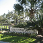
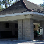
Audubon Park Shelter #11
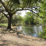
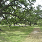
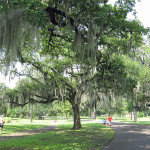
“Audubon Park (historically French: Plantation de Boré) is a city park located in the Uptown neighborhood of New Orleans, Louisiana in the United States. The park is approximately six miles to the west of the city center of New Orleans and sits on land that was purchased by the city in 1871. It is bordered on one side by the Mississippi River and on the other by St. Charles Avenue, directly across from Tulane University and Loyola University. The land now housing the park was a plantation in colonial days. It was used by both the Confederate and the Union armies in the American Civil War, and as a staging area for the Buffalo Soldiers.” -Wikipedia
Location
Shelter #11 is located at the northeast corner of Audubon Park near the intersection of St. Charles Ave. and Exposition Blvd. Enter the park at the St. Charles Ave. entrance and take the trail southeast. Shelter #11 is on the first turn. Map
Directions via Car
Parking can sometimes be challenging in the area as there is only street parking.
Directions via Public Transit
Normally the St. Charles Ave. Streetcar could take you from Canal St. right to the entrance on St. Charles Ave. but there is construction on a large portion of the line (from Erato St. west to Webster St.). There is a bus bridge servicing this section though. RTA Service Alerts